As my original plan of seeing Death Valley in one day didn’t pan out I had returned on my way back to Los Angeles. This time I drove in from the west on route 374 and took Scotty’s Castle Road up north. Because on my first day here I overheard a man at the visitor center calling Titus Canyon “the most beautiful drive in the entire US” I had become super curious about it. The ranger did tell me it was an unpaved road, however she also said I’d be ok with my small car driving up the 3 miles to the mouth of the canyon. So this morning I was determined to do so! The road was bad for my small car, and I quite regretted venturing out on it after about 1/2 mile but kept on driving since I was already out there. Eventually I got to the parking lot, there were 3 or 4 other cars parked there but I didn’t see or hear anyone. I walked into the canyon for a while, not very long maybe 15 minutes and found it eerily quiet and lonesome, so I decided to walk back to the parking lot. It was beautiful, but in spite the ranger telling me I’d be ok going there on my own, after having gone, I wouldn’t recommend driving out there in a small car and not alone as I was since this is an area where few visitors venture and in case a rock slides and hits you or something else happens to you it could turn into a very dangerous situation. Remember, there is no cell reception in Death Valley!
![[wIMG_0583]](https://www.restlesscuriosity.com/wp-content/uploads/2014/01/wIMG_0583.jpg)
![[wIMG_0584]](https://www.restlesscuriosity.com/wp-content/uploads/2014/01/wIMG_0584.jpg)
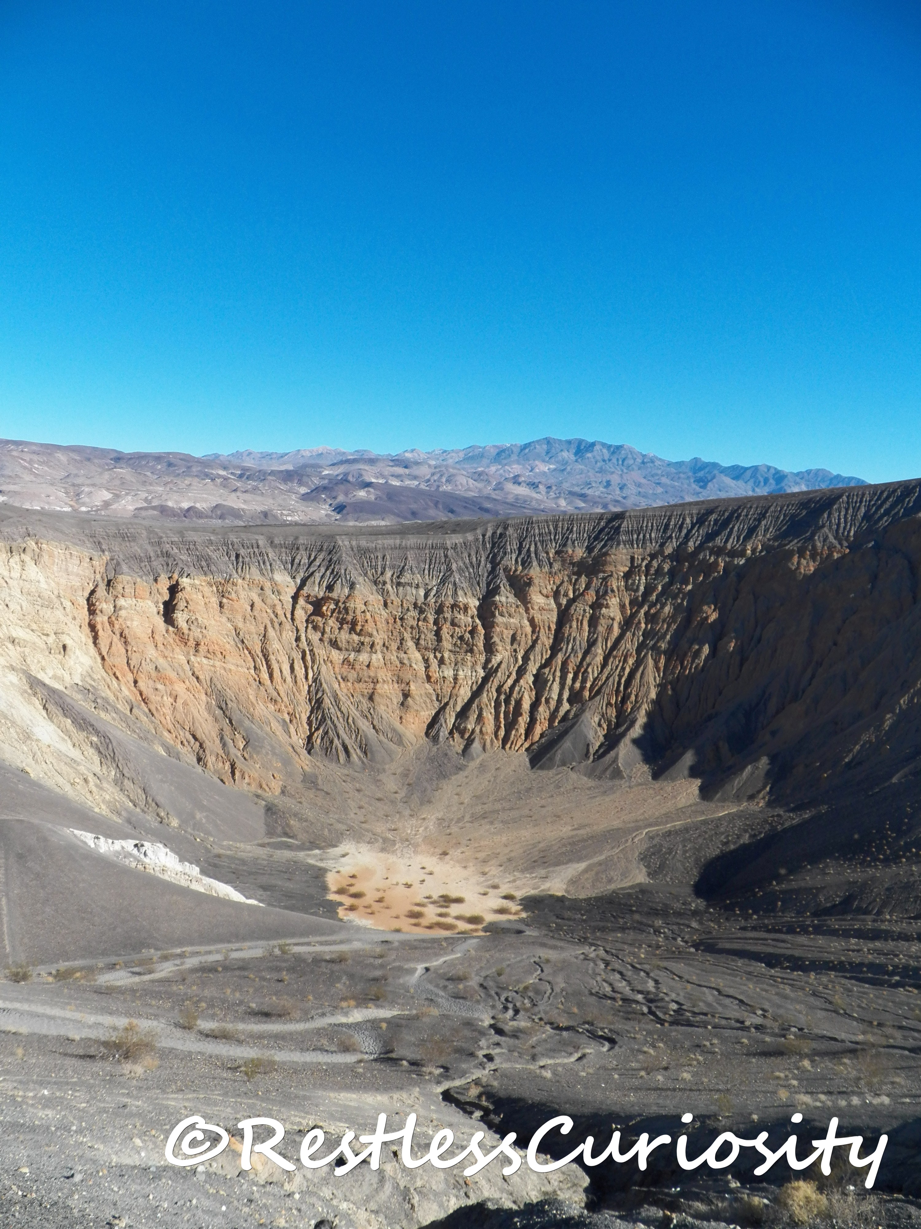
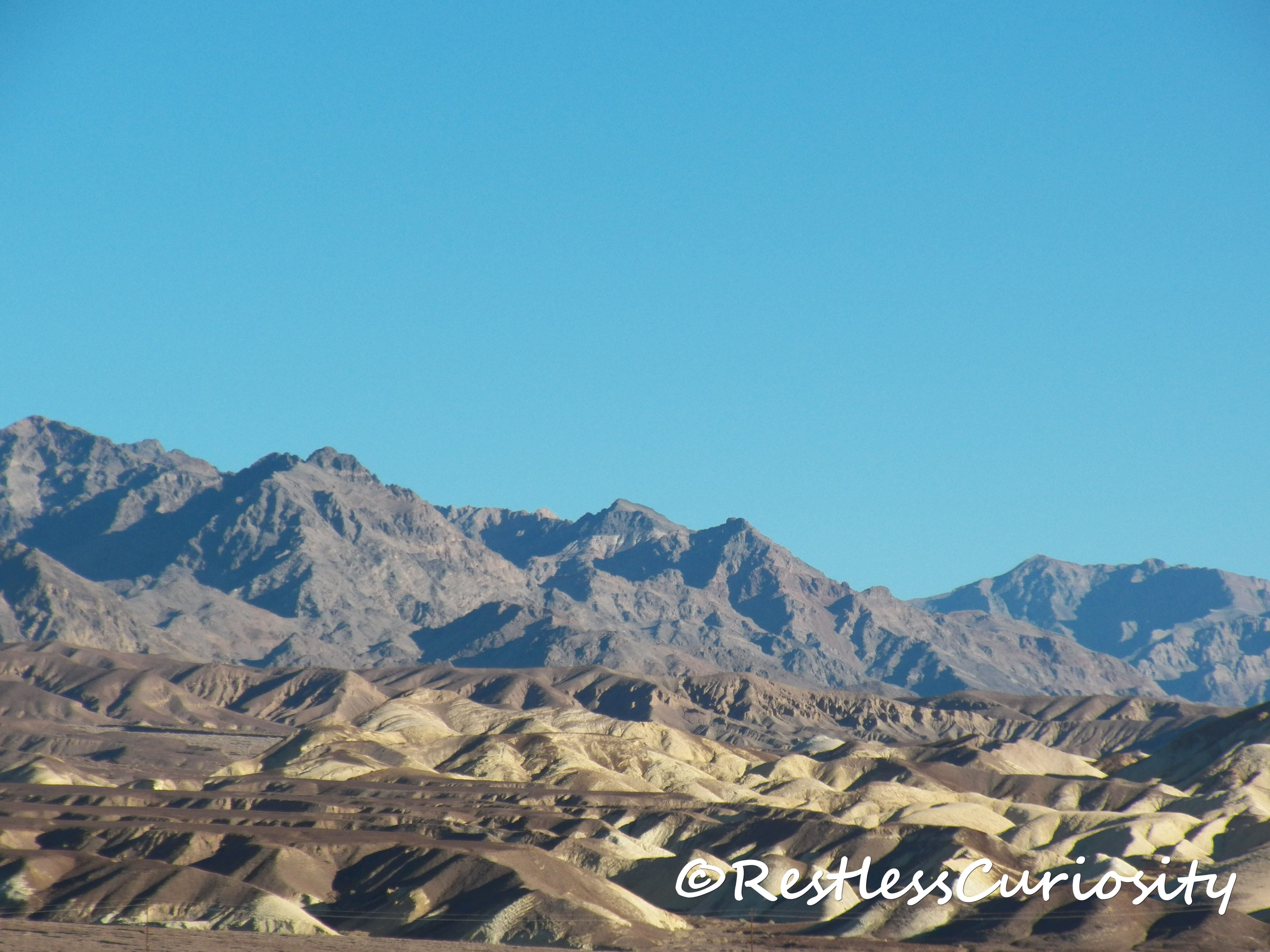
After Titus Canyon, I headed up north to Ubehebe Crater. Because it is so up north and apart from Scotty’s Castle the paved road doesn’t lead to any other points of interest many visitors probably don’t bother coming all the way up here. If you do make the drive make sure you walk to the top of the crater and around and you will see the smaller craters next and behind Ubehebe. You can also go down all the way to the bottom of it.
![[wIMG_0607]](https://www.restlesscuriosity.com/wp-content/uploads/2014/01/wIMG_0607.jpg)
![[wIMG_0610]](https://www.restlesscuriosity.com/wp-content/uploads/2014/01/wIMG_0610.jpg)
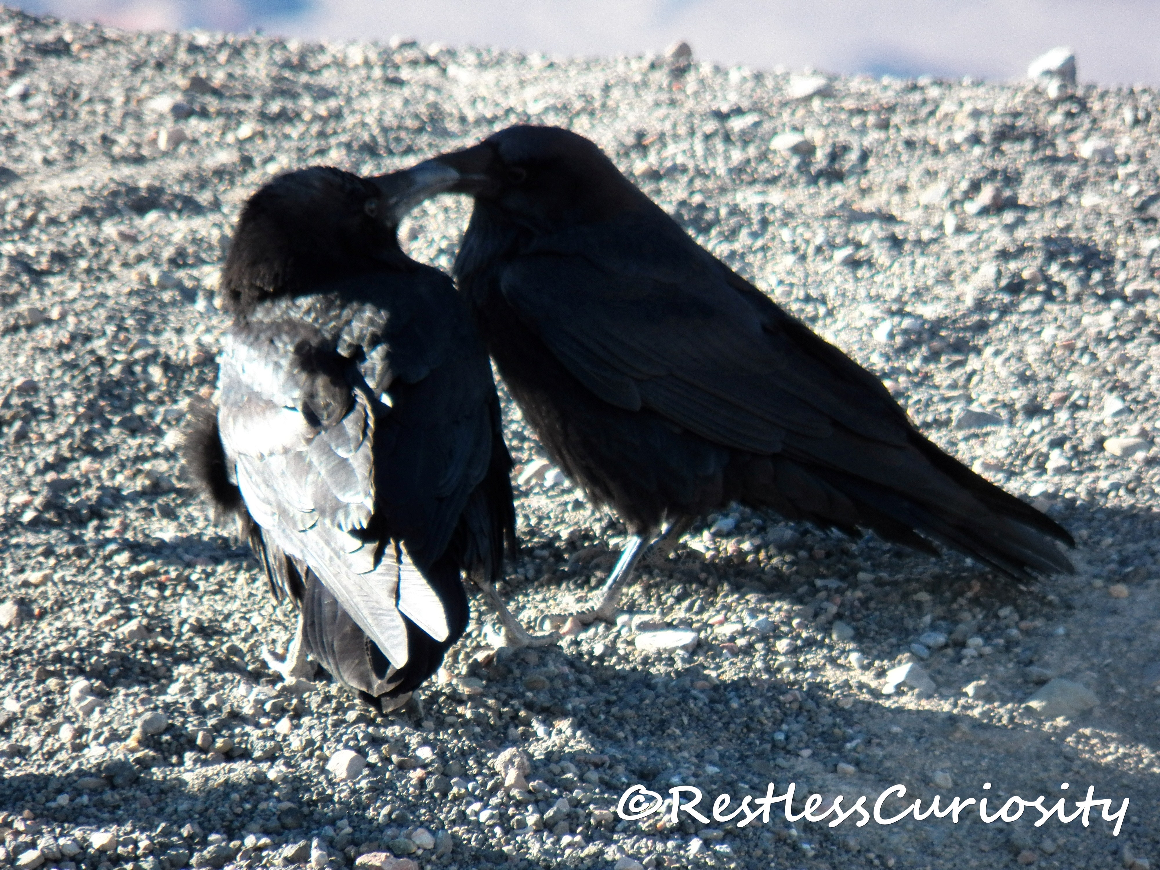
Two little lovebirds by the crater, how cute are they!!!
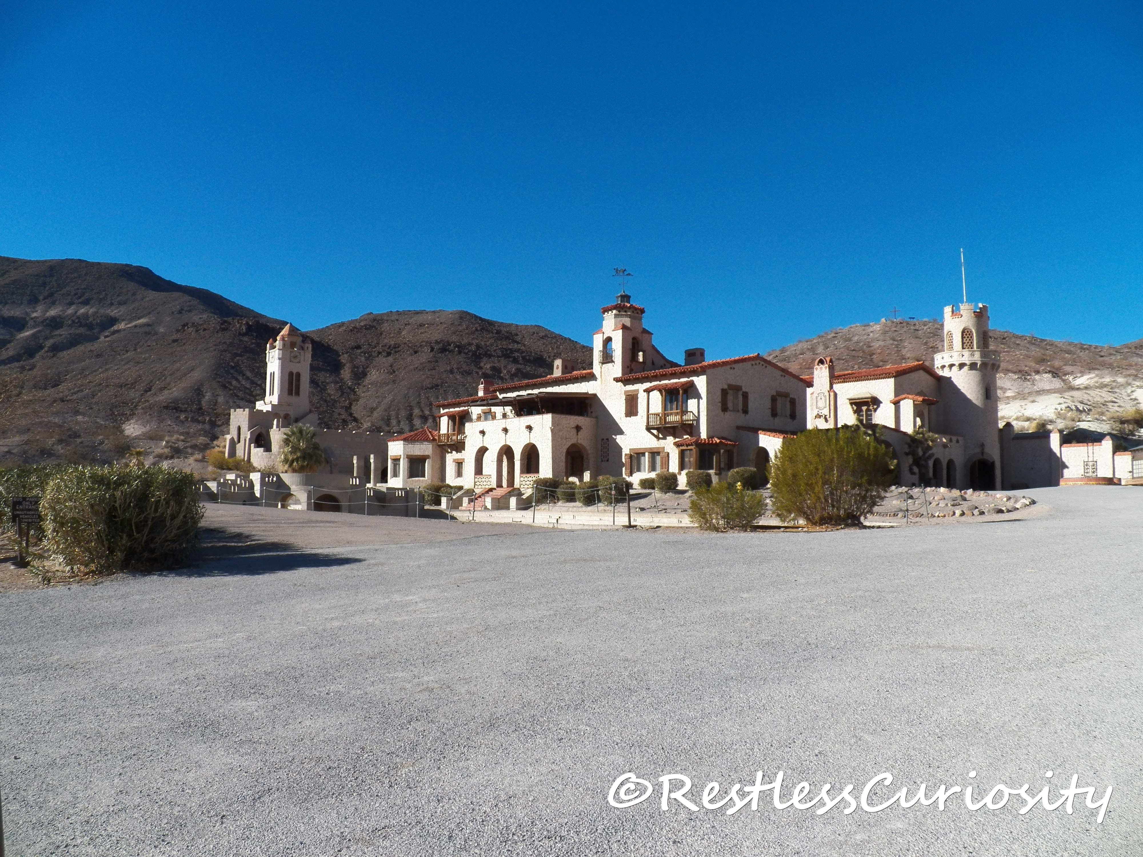
From Ubehebe it is only 3 miles to Scotty’s Castle, I drove over there, but did not take the tour as I was afraid I’d run out of time and I was more interested in seeing the natural wonders Death Valley has to offer. Perhaps on a future visit. The house looks impressive even just from outside, especially since it is in the middle of nowhere.
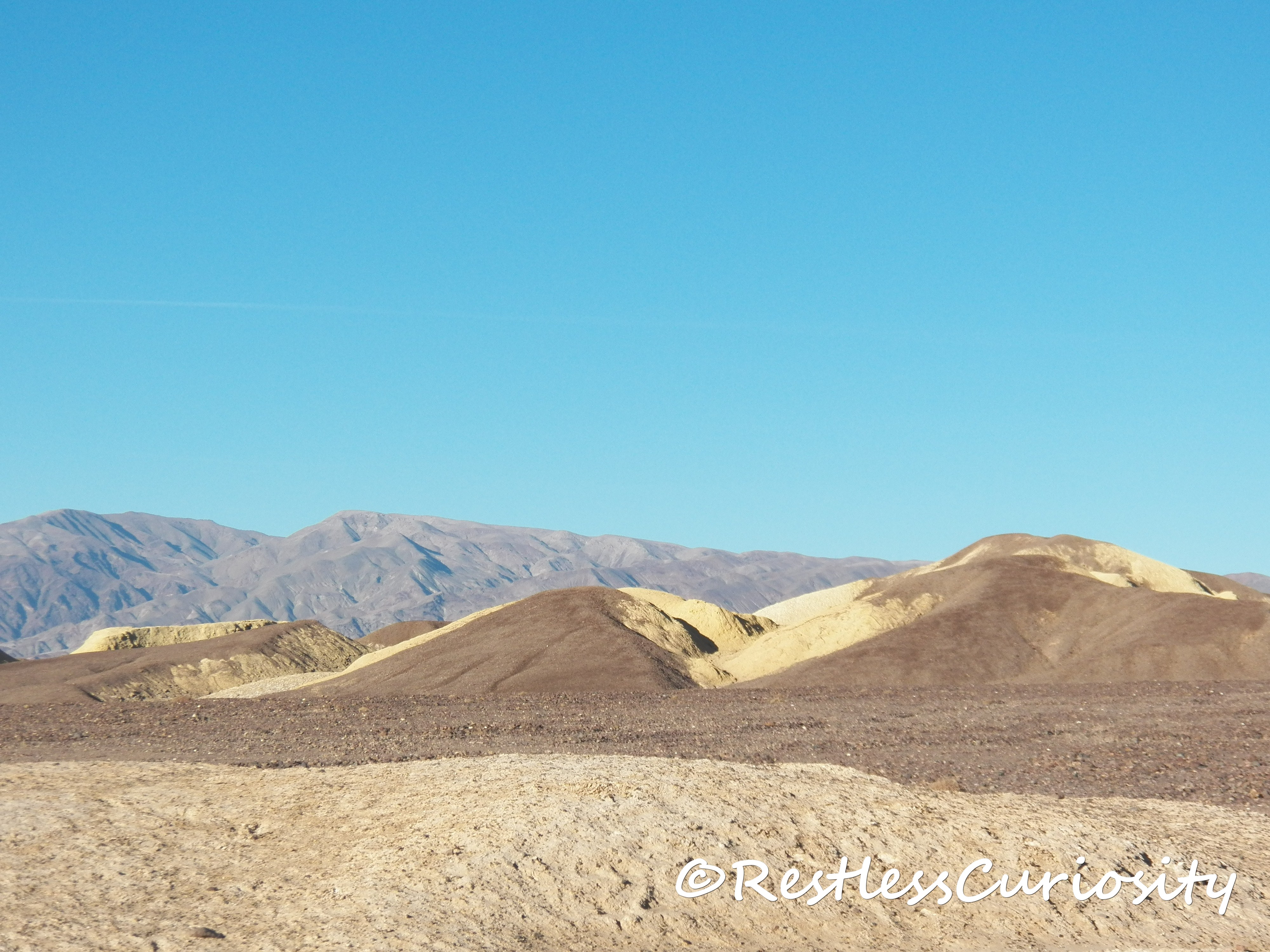
My next stop was at Mustard Canyon. Unfortunately none of my photos truly captured the beauty of these rocks.The mustard yellow and brown hills alternated in such unison one would think they were painted as such. It really is quite a spectacular landscape.
As I headed south along the 190 I came to a spot with a salt flat near the road. I decided to stop and take some pictures. There was a wide flat rocky terrain leading to the salt flat and as I came closer to the small brown bushes surrounding the salt flat I thought I heard a crackling sound, something different than the noise my boots made on the rocks. I stopped, the rattling continued and got louder and in a second I realized it was a rattle snake! I turned on my heals and ran as fast as my feet could take me! I had always wondered if I’d notice a snake’s rattle if I was out and about absorbed in the views around me or busy snapping pictures!
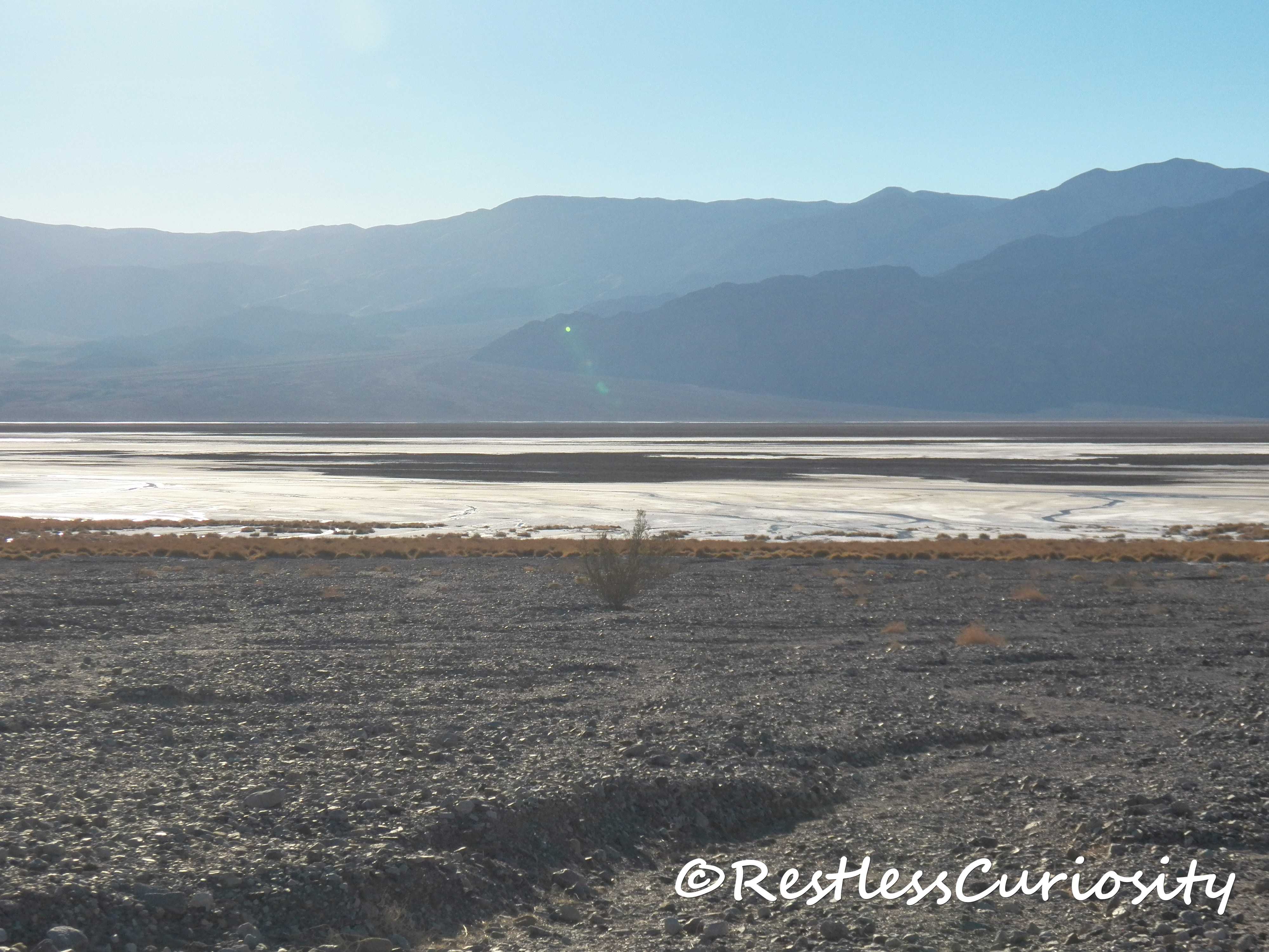 ↑ see those small bushes around the salty area? That’s where I got warned by the snake to keep out!
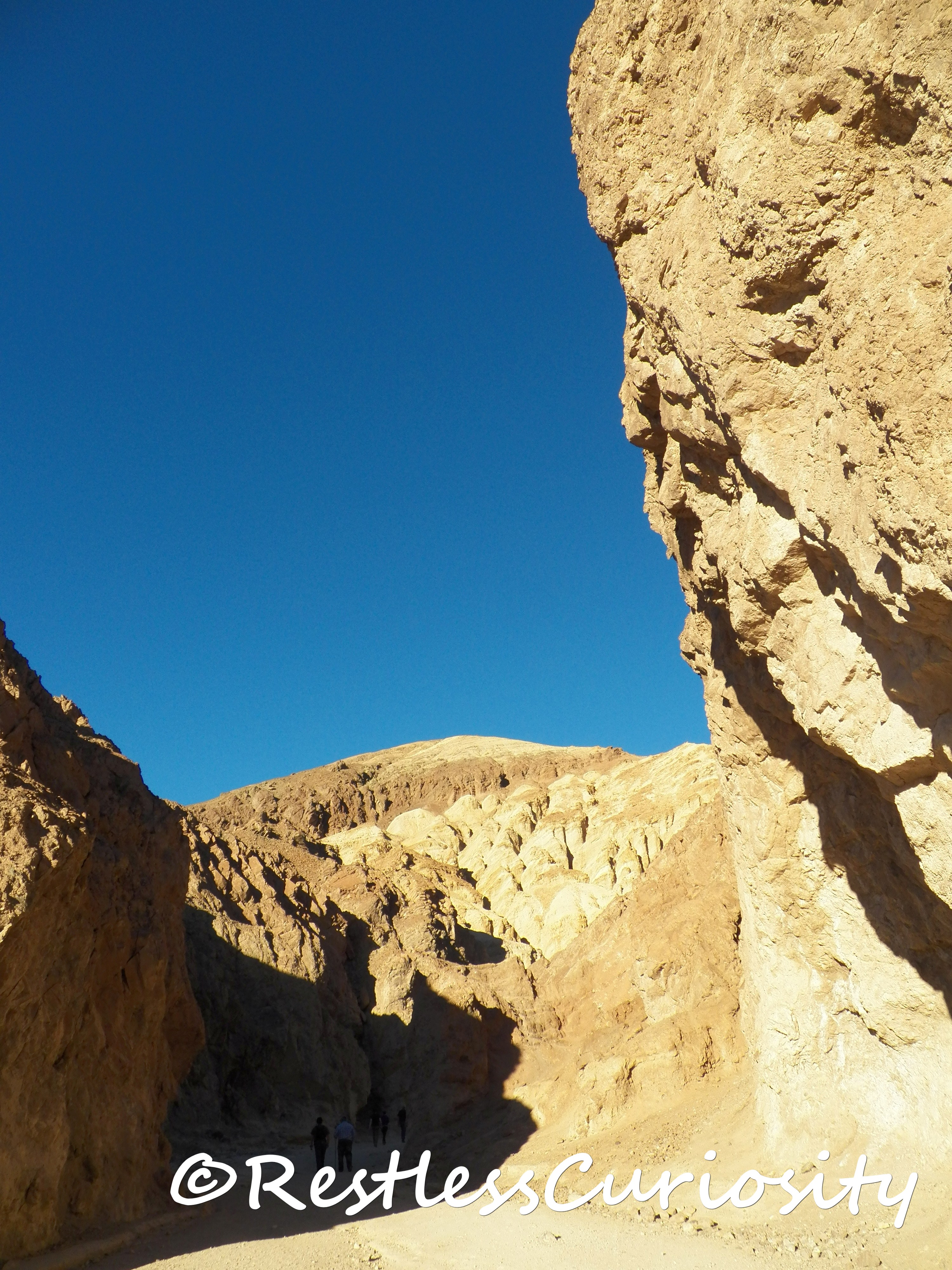
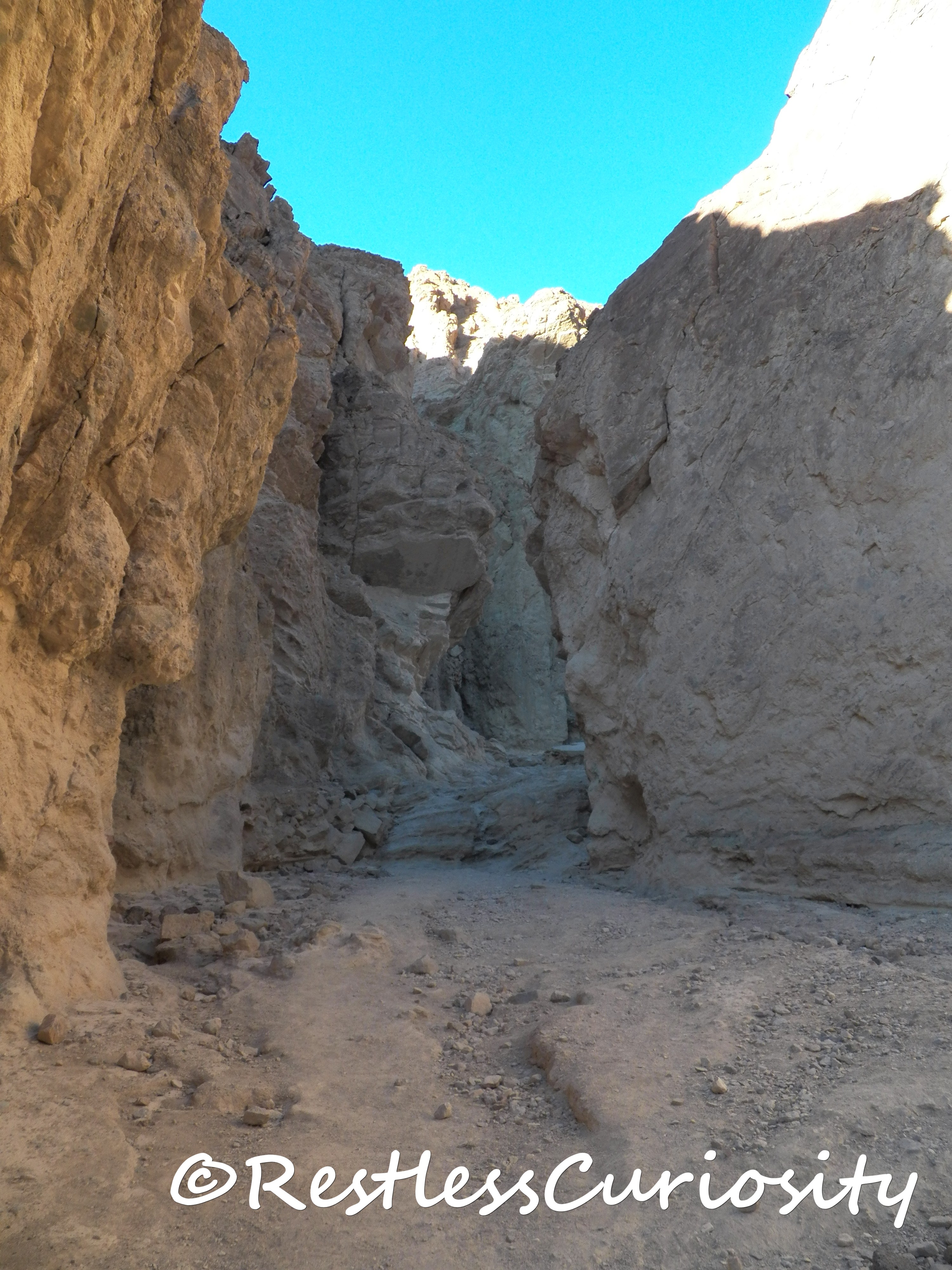
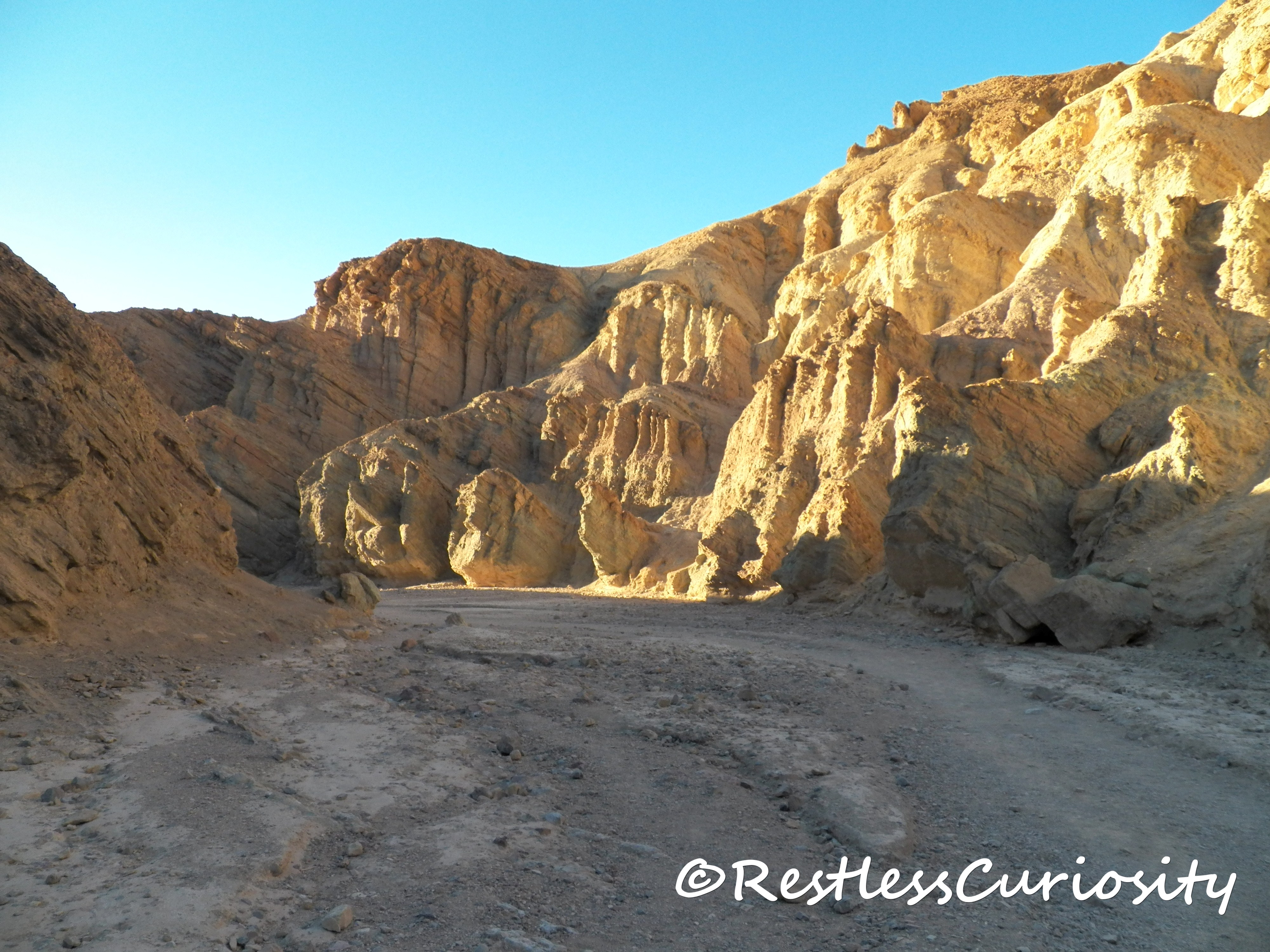
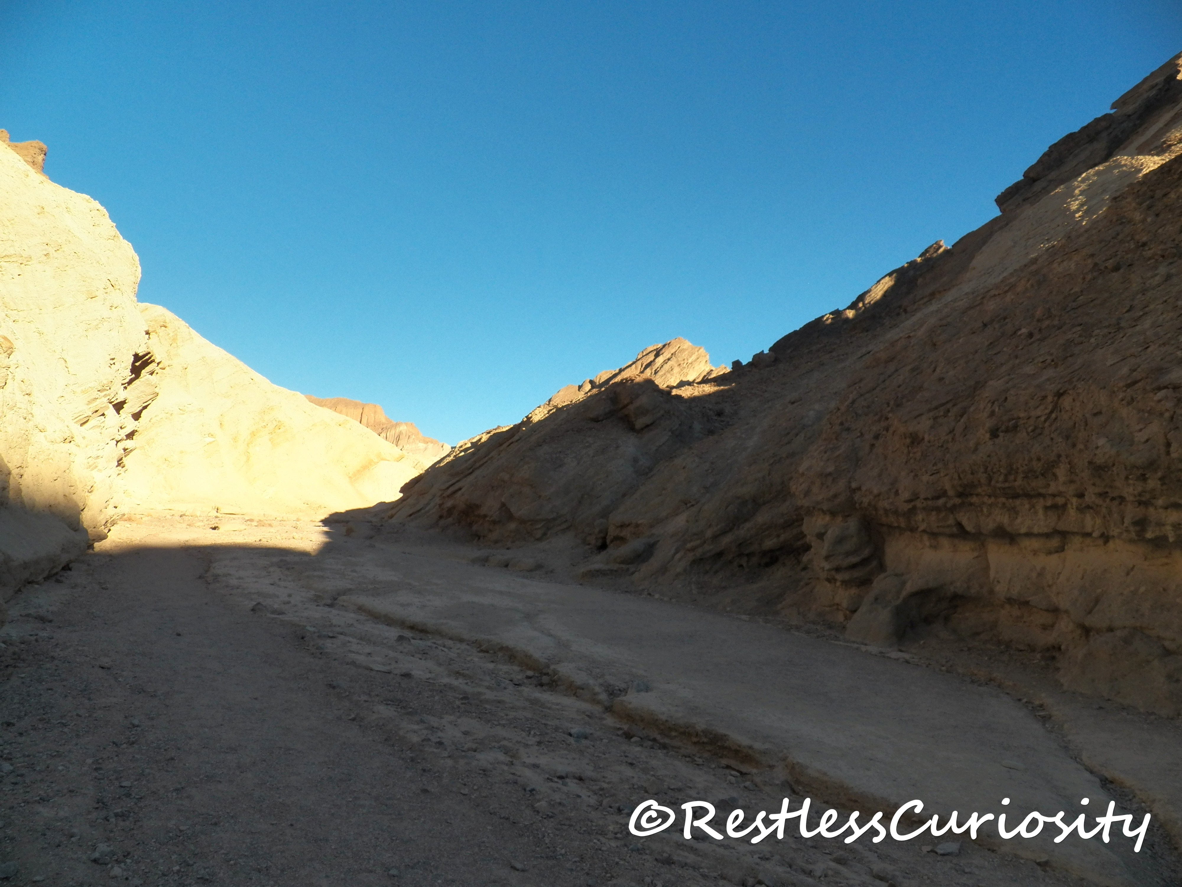
Next stop was at Golden Canyon off of Badwater Rd. It is a beautiful, easy hike about a mile in length into the corridor of bright orange canyon walls. It is a dead end, you walk back on the same path to the parking lot.
![[wIMG_0617]](https://www.restlesscuriosity.com/wp-content/uploads/2014/01/wIMG_0617.jpg)
![[wIMG_0620]](https://www.restlesscuriosity.com/wp-content/uploads/2014/01/wIMG_0620.jpg)
![[wIMG_0626]](https://www.restlesscuriosity.com/wp-content/uploads/2014/01/wIMG_0626.jpg)
![[wIMG_0633]](https://www.restlesscuriosity.com/wp-content/uploads/2014/01/wIMG_0633.jpg)
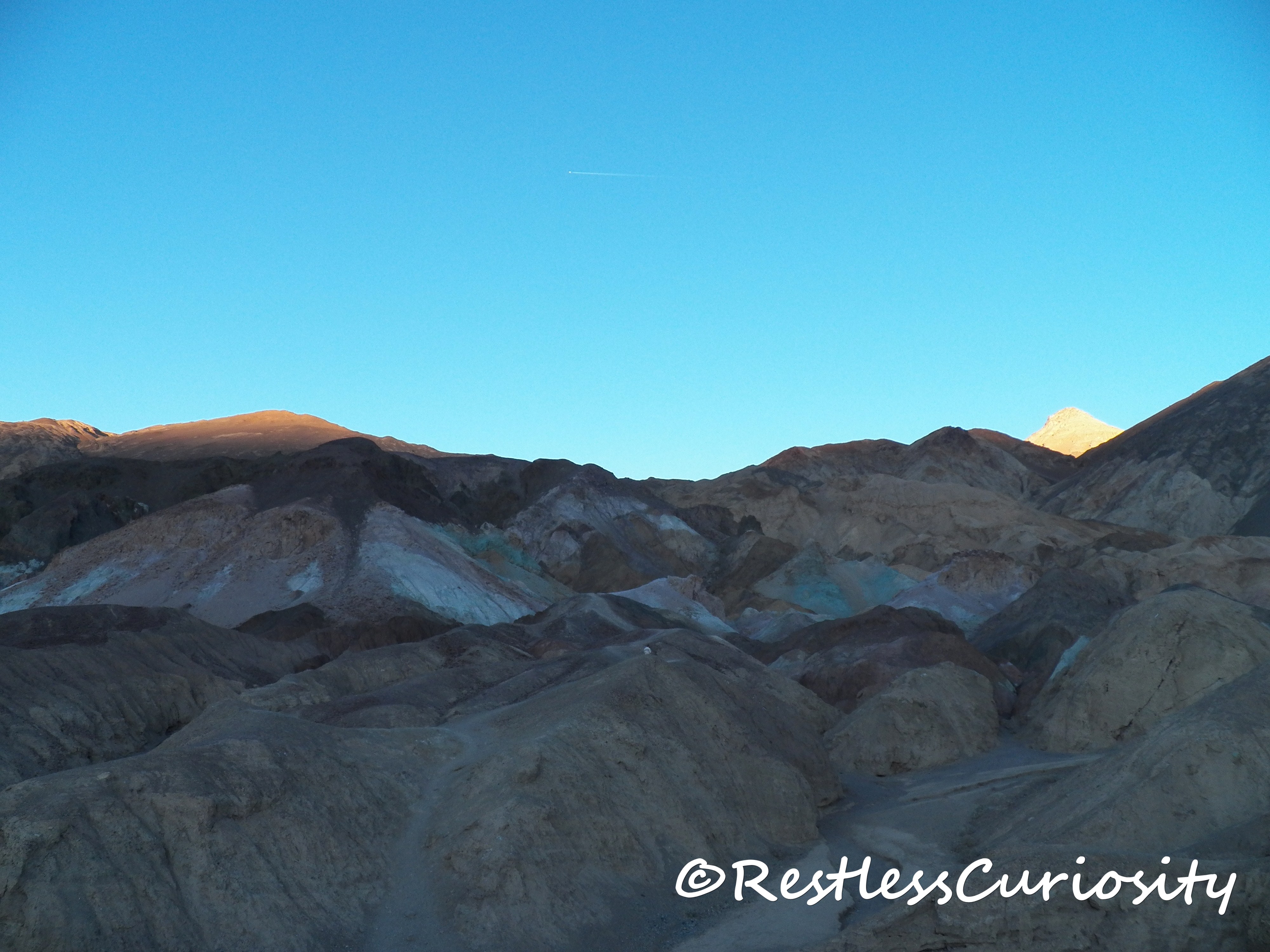
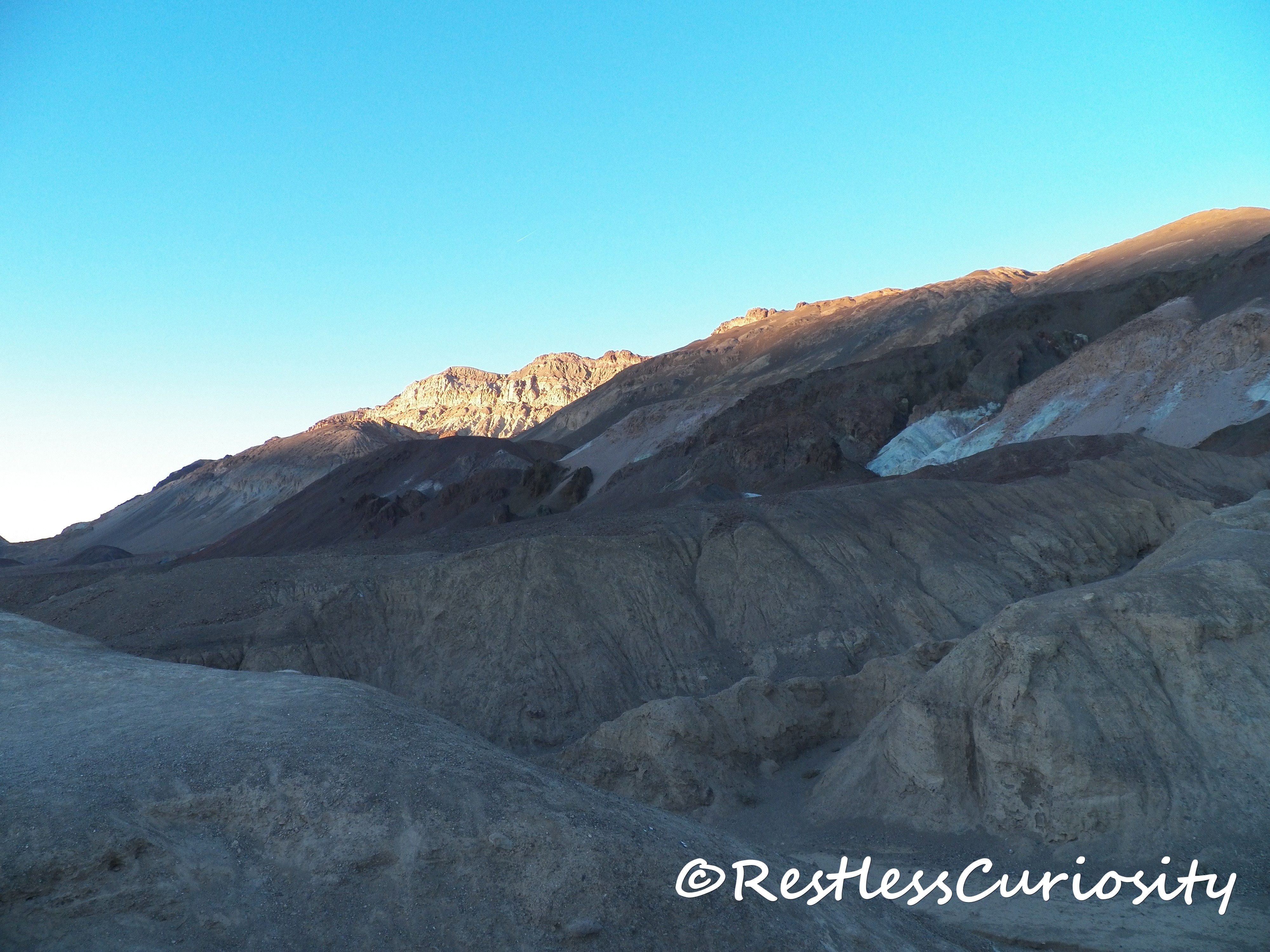
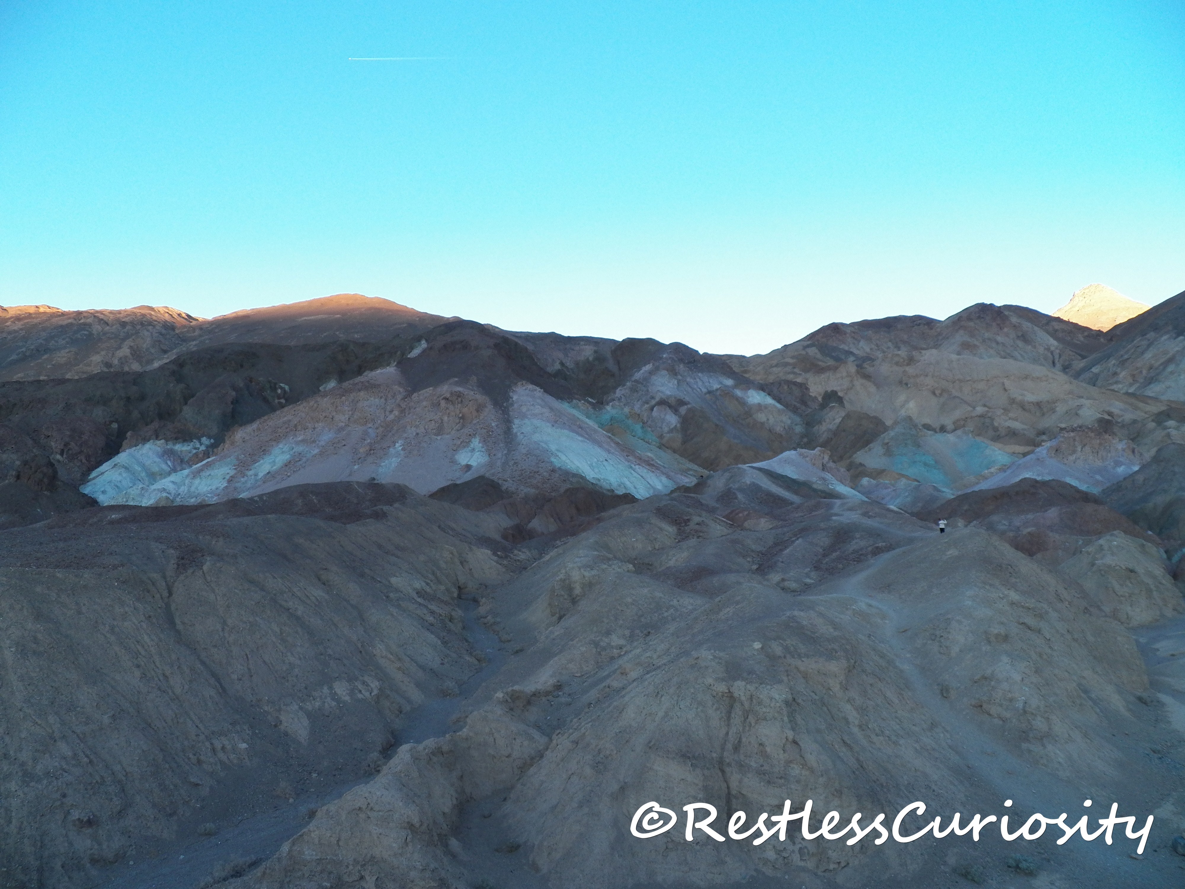
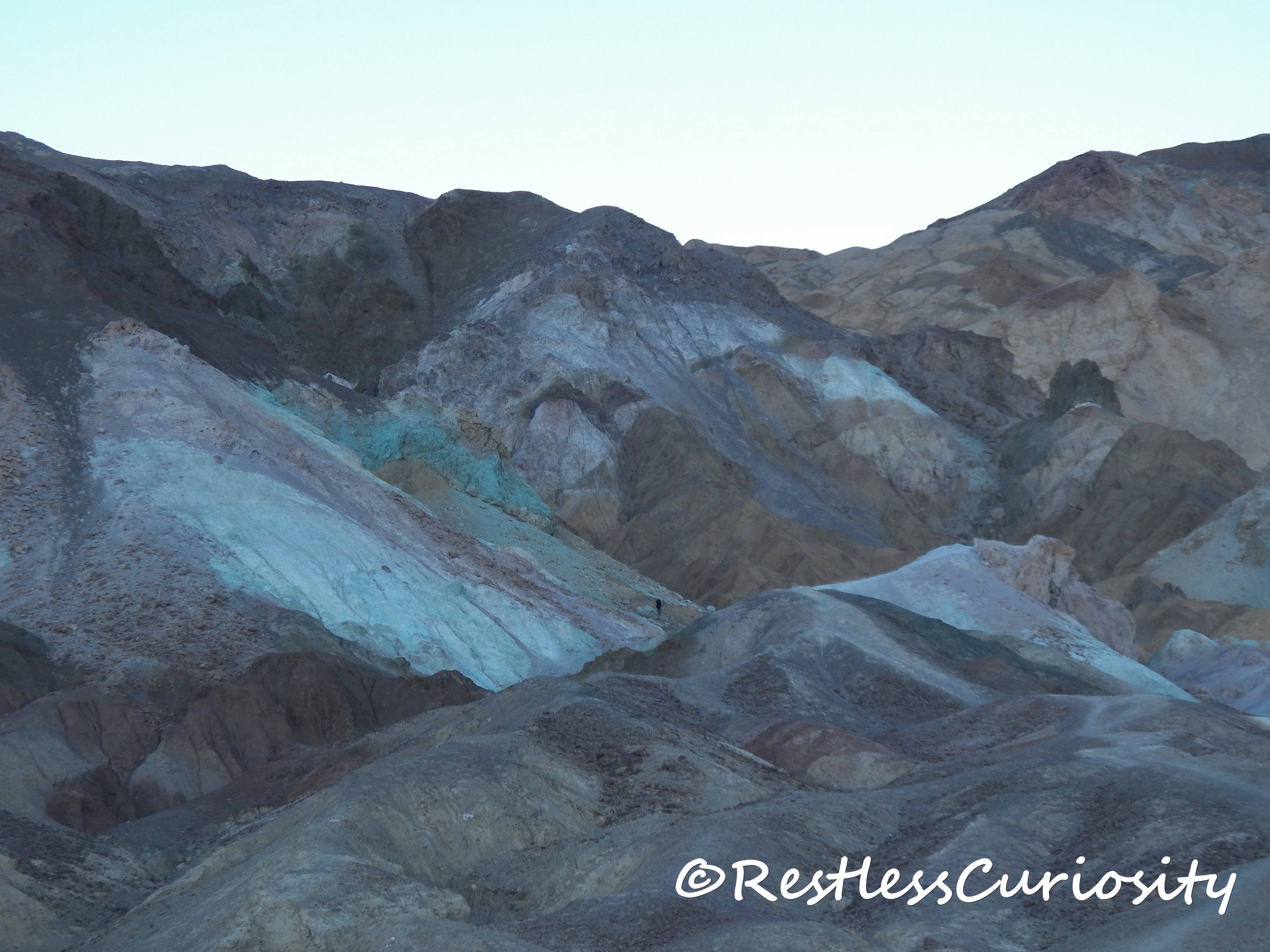
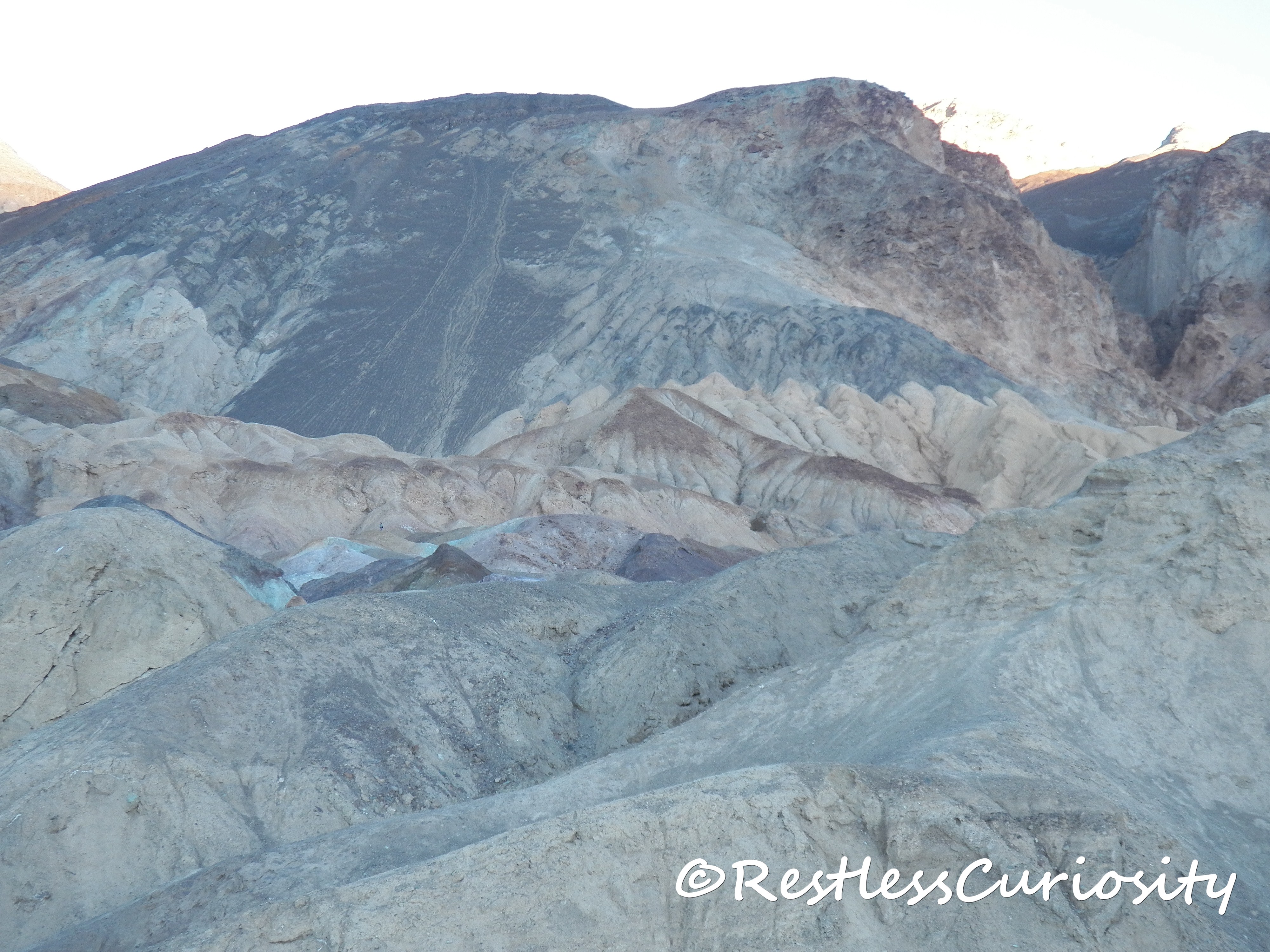
Only a few miles south of Golden Canyon is an area called Artists’ Palette, a loop drive off of Badwater Rd on Artist’s Drive. I highly recommend planning a minimum of 1 hour for this spot, much more if you are a photography aficionado and would also like to do a bit of hiking. The colorful hills are the result of volcanic ash and minerals such as iron, magnesium, aluminum, titanium, red hematite and green chlorite interacting with water and high temperatures over the course of 5 million years.
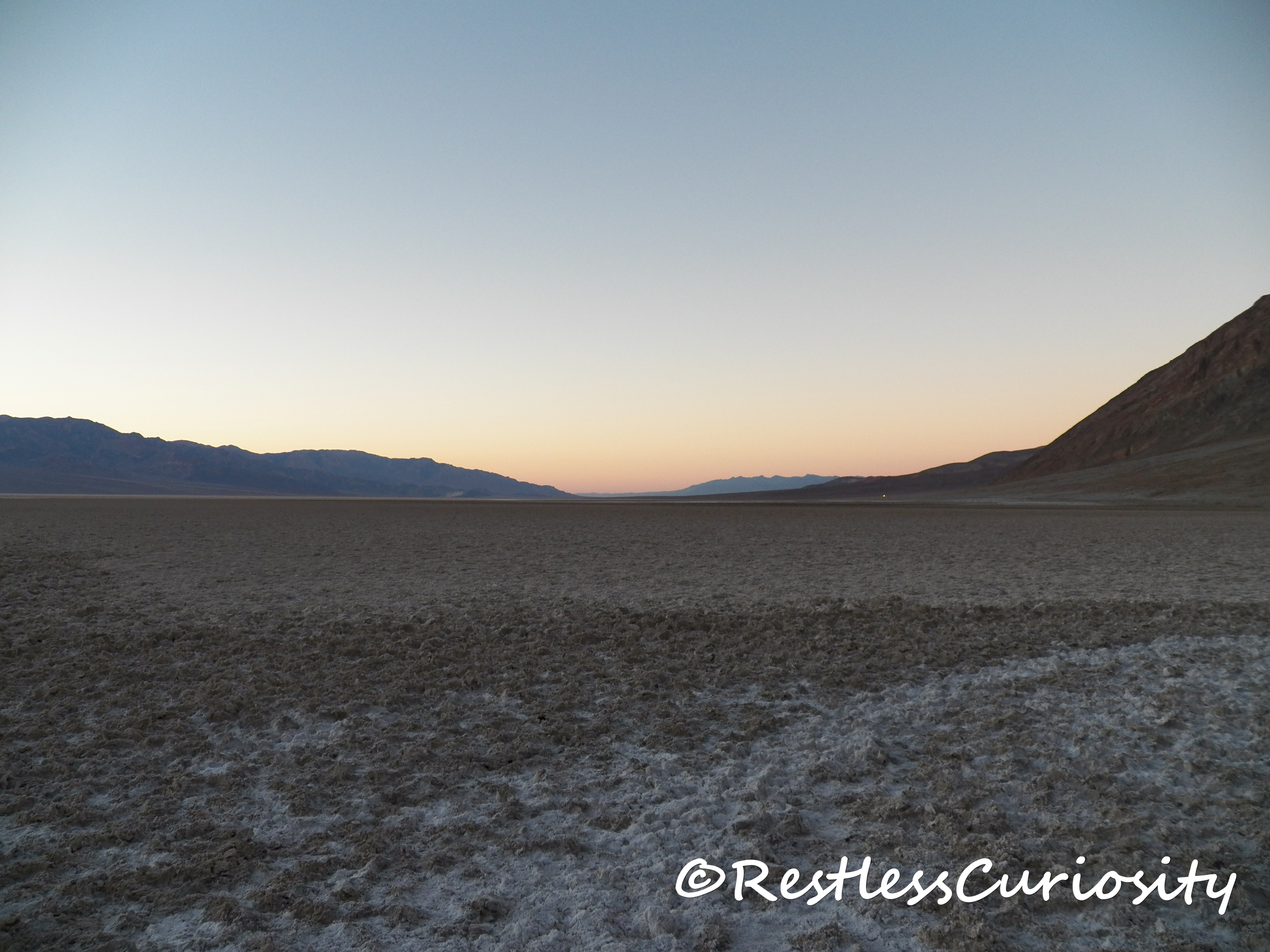
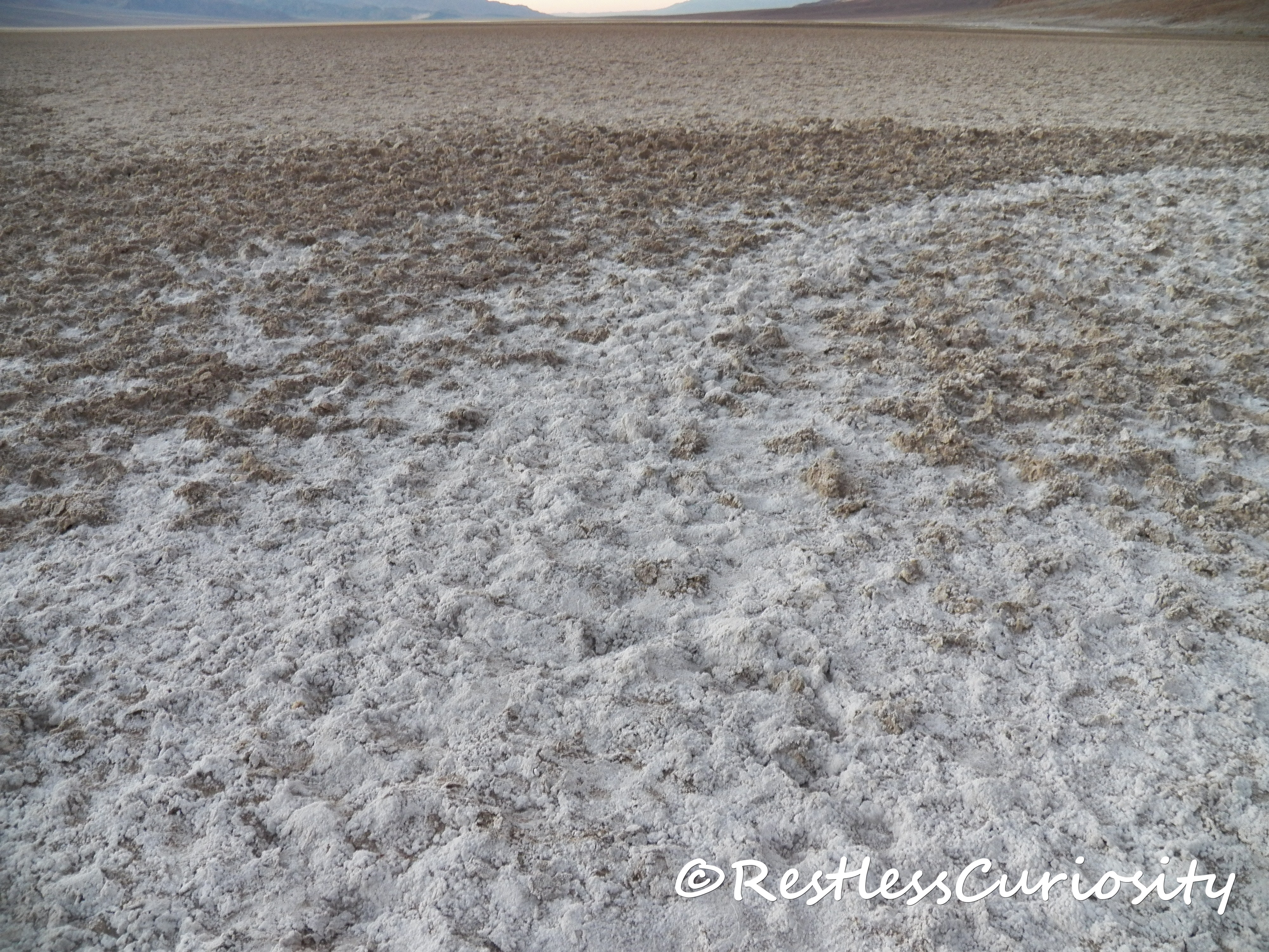
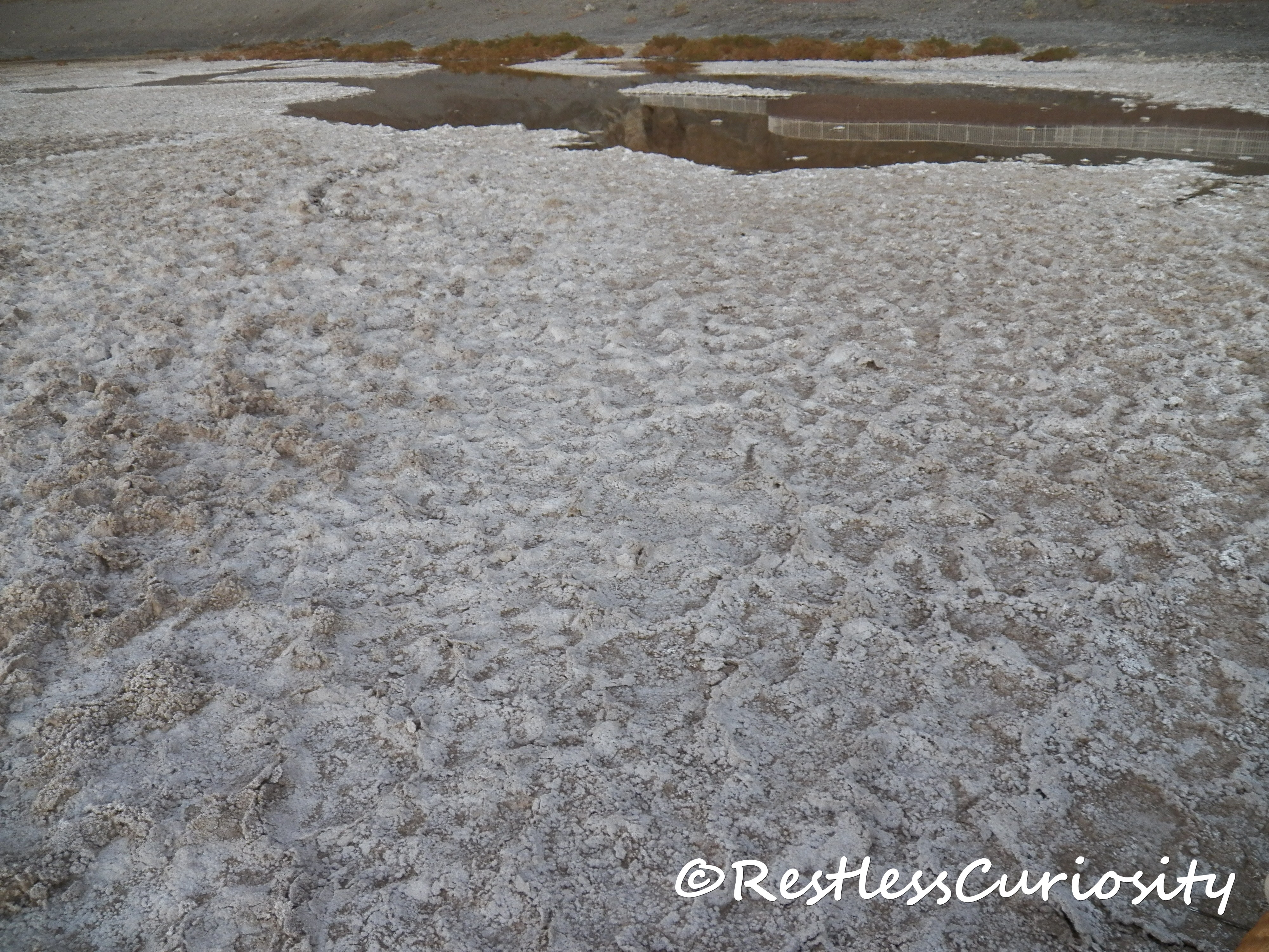
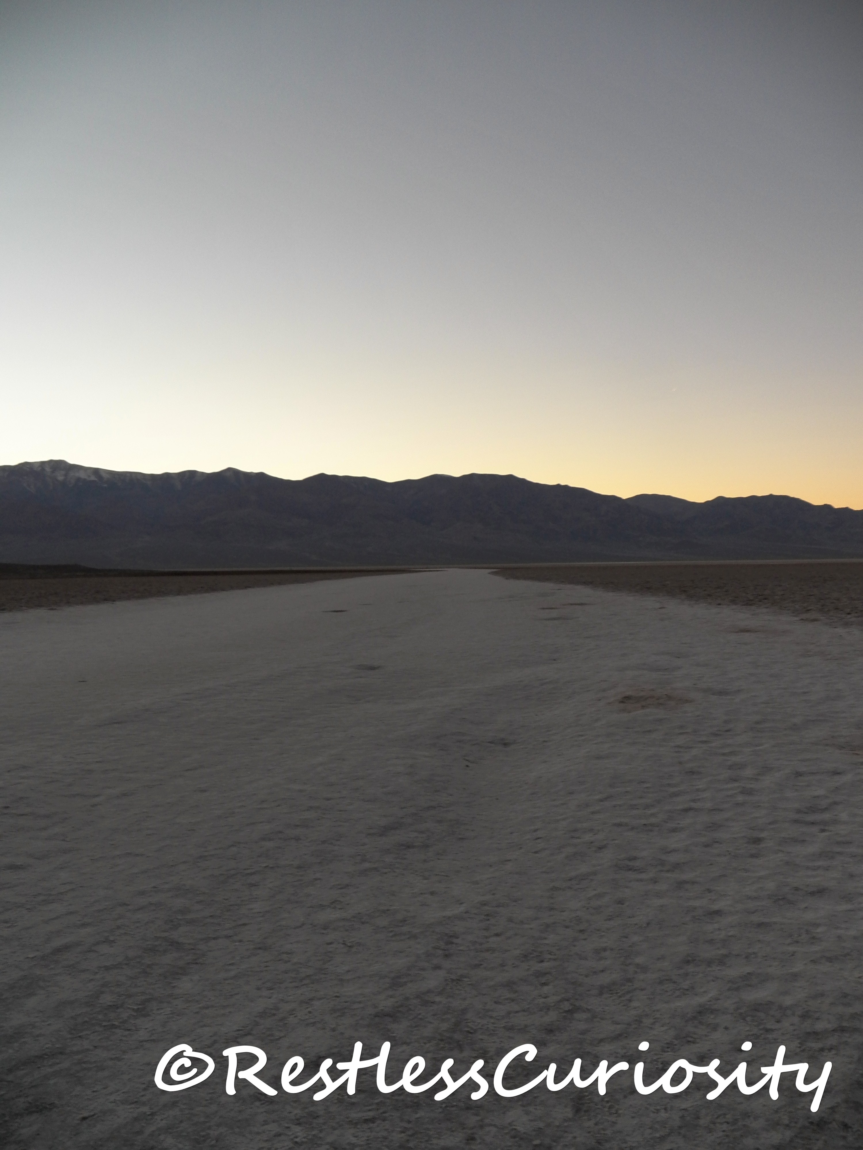
As on my first day in Death Valley I once again found myself chasing the sun, wanting to be at Badwater Basin before sunset. This is the lowest point in North America, 282 ft below sea level!
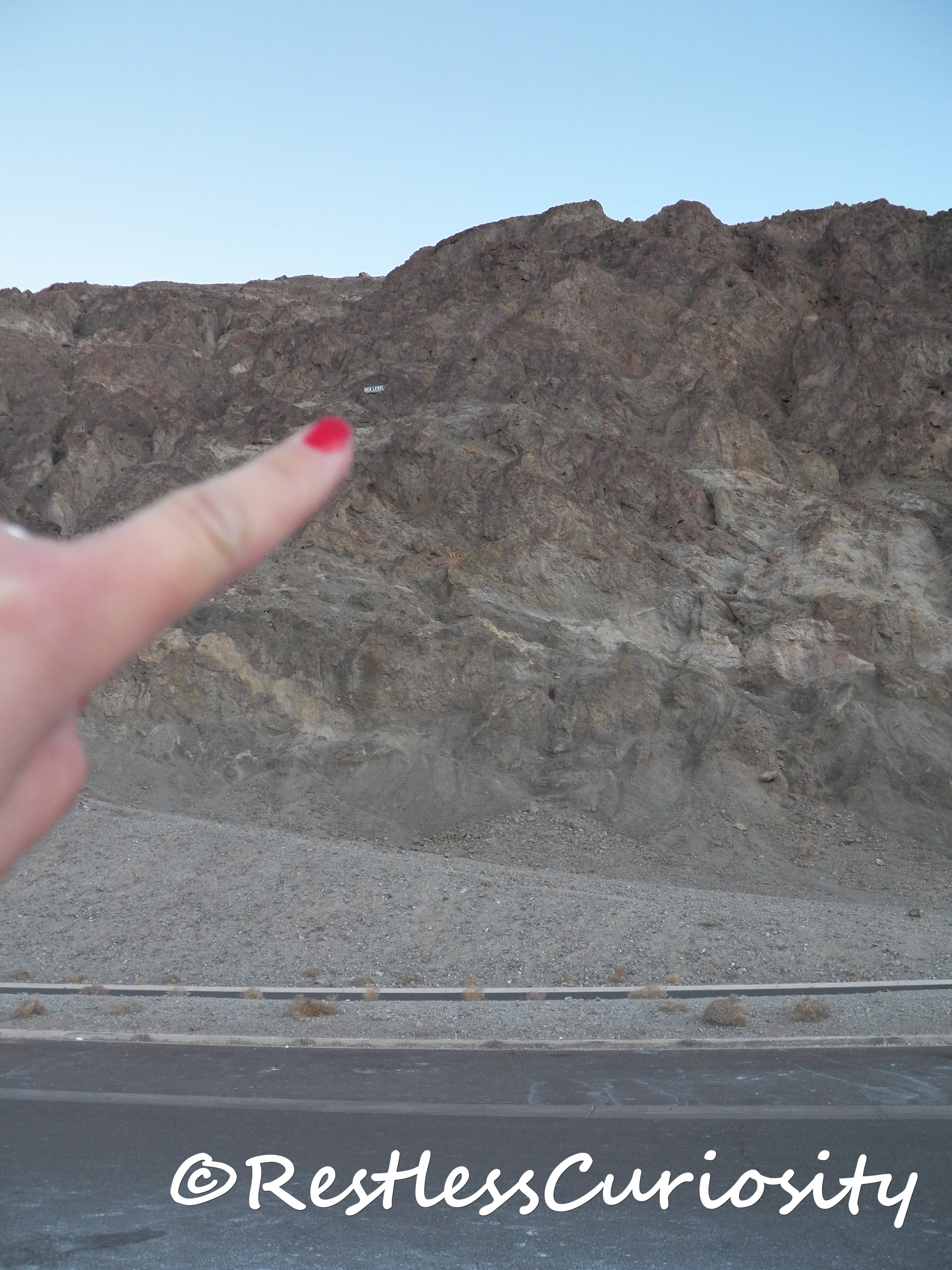
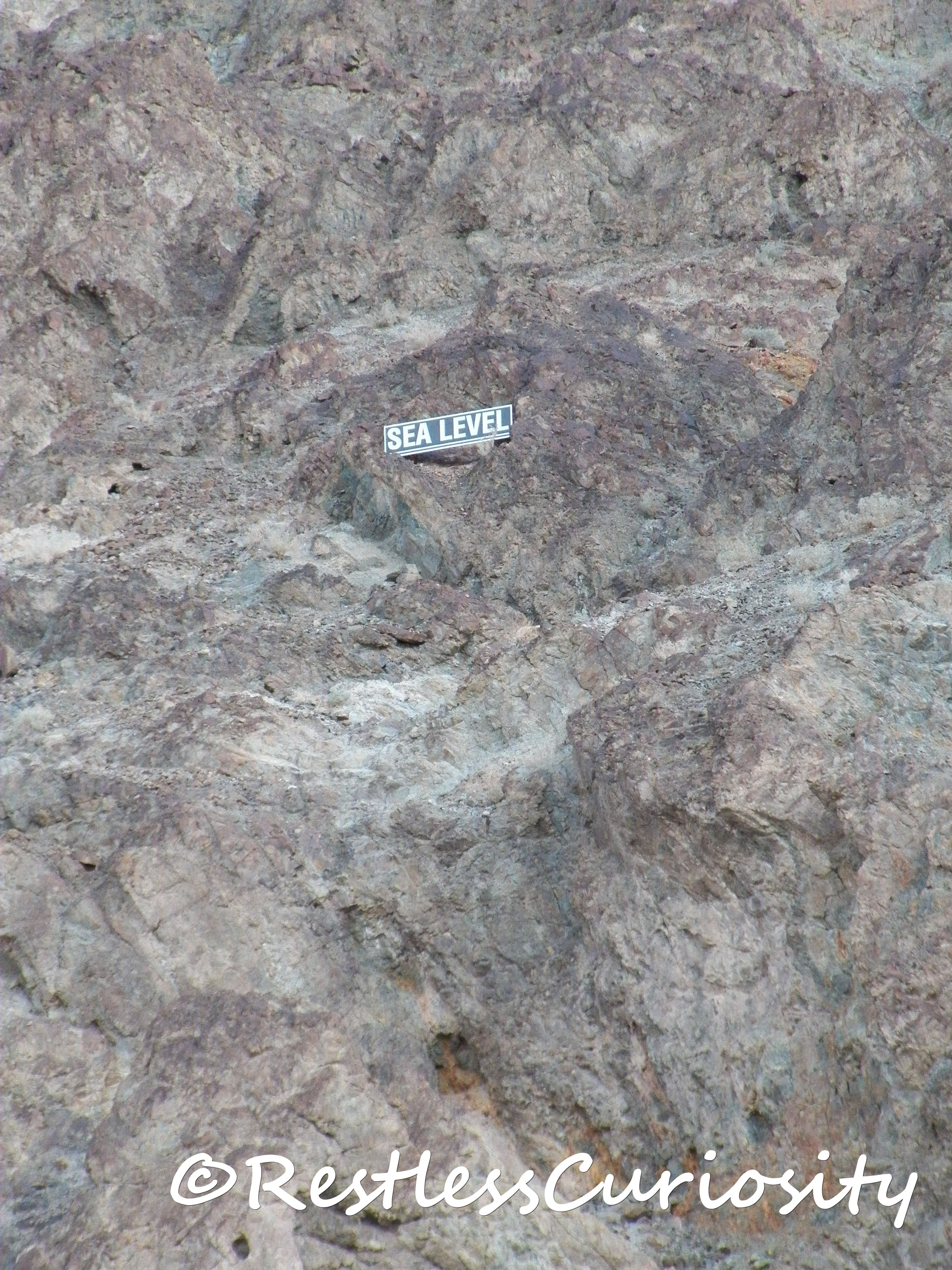
Measured from the highest point in Death Valley(Telescope Peak at 11,049 ft) to the lowest here in Badwater Basin, the vertical distance is twice as much as the depth the Grand Canyon! The salt cover is so thick it looks like snow. You can walk out on the salt beds and for sure you’ll want to take some photos but other than that this spot shouldn’t take up too much of your time.
![[wIMG_0645]](https://www.restlesscuriosity.com/wp-content/uploads/2014/01/wIMG_0645.jpg)
By the time I drove out of Death Valley it was pitch dark, the sky looked amazing although I didn’t catch any shooting stars. I was so happy I visited and I’m really hoping to be back and focus only on certain areas I liked most and do more hiking. I’d love to also do a trip with a high clearance vehicle and see some of the spots such as the Racetrack and Eureka Dunes which require long drives on unpaved roads.
***If your time is very limited or you have only one day, I’d say focus on the south east side of Death Valley, south of Furnace Creek, between the 190 East and 190 West is the highest concentration of easily accessible amazing landscape and easy gorgeous hiking.***

